|
| |
|
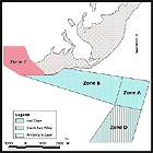
ZONE C
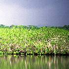
The mangrove habitat contains seven mangrove cayes and several navigable channels including the "Boca Chica" channel which borders the southern tip of Ambergris Caye.
|
|
||||
 The mangrove habitat contains seven mangrove cayes and several navigable channels including the "Boca Chica" channel which borders the southern tip of Ambergris Caye (also the southernmost point on the Yucatan Peninsula). The precise location of the Hol Chan border among this coastal fringing mangrove zone has been a matter of dispute between park personnel and developers. Although most of the mangroves and other vegetation in the area have already been cleared, a fringing border of primarily Rhizophora mangle (red mangrove) extends along the intertidal zone, with a width of approximately 11 - 22 meters and an average height of 4 - 5.4 meters (Dotherow, 1992c ). There is a small dock and some identification signs for park interpretation and education in this area.
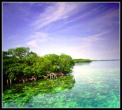
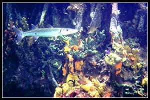
The "Boca Chica" Channel itself is approximately 3 meters deep, tapering up to about 1.5 meters along the mangrove borders. Seagrasses Thalassia, Syringodium and calcareous algas halemedia and penicillus are found in patches from sparse to dense, throughout the channel. 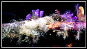 Tunicates, Anemone and Brittle Stars on Mangrove Root | ||||||
 Water clarity fluctuates widely from an estimated 1 - 8 meters. The dominant mangrove species, R. mangle, also lines the other channels and islands in this zone, providing abundant mangrove root system habitat. These root systems host a variety of sponges, tunicates, invertebrates and juvenile fish. Several of the islands also include dry land with other mangrove species such as Laguncularia racemosa (white mangrove), Avicennia germinans (black mangrove), and Conocarpus erectus (buttonwood). One of the cayes near the north eastern reserve border is also a favorite roosting area for a variety of birds.
| Zone A - Coral Reef | Zone B - Grass Beds | Zone C - Mangrove | Zone D - Shark-Ray Alley |
|
Copyright ©
- Naturalight Productions Ltd.
The URL of this page is: |